Deliver on Flight One: 7 Step Drone Mission Planning for Operators
Deliver on Flight One: 7 Step Drone Mission Planning for Operators
Drone mission planning means aligning three decisions before takeoff: what the deliverable requires, how flight geometry meets that accuracy, and which positioning strategy backs it up. Get the sequence wrong and you re-fly the site. Get it right and the mission produces usable data the first time, whether that’s a survey-grade orthomosaic, an inspection report, or a mapping deliverable a client can act on.
- Accurate deliverable definition, including CRS and accuracy targets, must be established before planning to avoid errors that affect the entire workflow.
- Using higher overlaps, proper flight patterns, and terrain-follow features improves data quality but may increase battery consumption and flight time.
- The choice of positioning strategy depends on the accuracy required; ground control points are essential for legal and high-precision surveys.
- Pre-flight planning software with terrain awareness, safety features, and automation supports repeatable, precise mission design and reduces on-site uncertainties.
- Automating administrative tasks like airspace clearance, client management, and flight logs with integrated tools saves time and minimizes operational errors.
Table of Contents
- What Drone Mission Planning Covers and Why It Matters
- How to Design a Mission That Meets Spec on the First Try
- What to Look for in Mission Planning Software
- Field Checklist and In-Flight Quality Assurance
- Adjusting Mission Planning for Mapping, Inspection, and Corridor Work
- Where Dronable Fits Into the Mission Workflow
- The Part of Mission Planning Most Operators Get Backward
- Plan the Mission. Let Dronable Handle the Rest.
- Sources
What Drone Mission Planning Covers and Why It Matters
Planning starts with the deliverable, not the flight. Before you touch altitude or overlap settings, you need three numbers locked: the required accuracy, the coordinate reference system (CRS) the client expects, and the output format the deliverable demands. A construction site asking for centimeter-level volumetric data needs a completely different flight than a rooftop inspection looking for cracked shingles.
Professional survey work follows a five-stage workflow, and skipping steps at the front loads risk onto every stage after it. KOREC’s end-to-end survey workflow breaks it into preflight planning, ground control and site setup, data acquisition, processing, and deliverables. Each stage depends on the one before it. A mistake in the CRS setting at stage one doesn’t show up until processing, when your point cloud sits meters away from where it should.
Most reflights trace back to the same handful of planning errors:
- Coordinate mismatches between the mission plan, the ground control setup, and the client’s expected output CRS, which silently shift the whole dataset.
- Insufficient overlap for the terrain or vegetation type, leaving gaps in the photogrammetry model that only appear during processing.
- Wrong positioning strategy for the accuracy target, like relying on GNSS alone when the deliverable calls for survey-grade tolerances.
- Ignoring terrain variation, which produces inconsistent ground sample distance (GSD) across a site with elevation change.
- Underestimating battery needs, forcing a rushed mid-mission swap that breaks camera trigger timing or skips waypoints.
None of these are exotic mistakes. They’re the ordinary result of designing a flight before defining what the flight needs to produce.
How to Design a Mission That Meets Spec on the First Try
Follow this sequence every time, and adjust the details to the job, not the order.
- Confirm the deliverable and accuracy target first. Ask what the client will do with the data. A topographic survey for earthworks might need 2 to 3 centimeters of vertical accuracy; a rooftop condition report might tolerate several centimeters of GSD without issue.
- Convert accuracy into GSD and altitude. Lower altitude produces finer GSD but shrinks your per-flight coverage and burns more battery per acre. Match the altitude to the tightest accuracy requirement in the deliverable, not the average one.
- Pick your flight pattern. Grid patterns suit open, flat mapping jobs. Crosshatch, or double-grid, patterns fly the same area twice on perpendicular headings and dramatically improve reconstruction on vertical surfaces and complex rooflines. Corridor patterns fit linear infrastructure like pipelines, roads, and power lines.
- Set frontlap and sidelap. Aerotas recommends high frontlap and sidelap overlap as the professional baseline for photogrammetry. Push both numbers higher over dense vegetation, uneven terrain, or reflective surfaces like water and glass, where feature matching gets harder.
- Choose your positioning strategy. GNSS-only works for low-stakes visual mapping where a meter or two of error doesn’t matter. RTK or PPK delivers survey-grade accuracy in real time or through post-processing without needing ground control points, though it leaves you without an independent accuracy check. Ground control points (GCPs) add that independent validation and remain the right call for legal surveys, high-value construction monitoring, or any deliverable requiring a documented accuracy audit trail, a point Aerocartwright’s mapping workflow guide makes clear when comparing RTK/PPK against GCP-based control.
- Plan your batteries and mission segmentation. Estimate flight time against battery capacity and build in a margin for wind and cold. Most mission planning software will let you split a large area into segments that resume automatically on the next battery, so the aircraft picks up exactly where it left off instead of overlapping or skipping ground.
- Prefetch your maps and import terrain data. If the site has meaningful elevation change, import a digital elevation model (DEM) and enable terrain-follow so GSD stays consistent from the low end of the site to the high end.
Pro Tip: Terrain-follow keeps your GSD honest across elevation change, but it also increases battery draw because the aircraft is constantly adjusting altitude. Add one extra battery to your count on any site with more than about 15 meters of elevation variance.
What to Look for in Mission Planning Software
The right software turns the checklist above into a repeatable process instead of a mental exercise you redo from scratch every time. Not every tool handles every step well, so evaluate against what the job actually needs.
For core mission design, look for polygon draw tools that auto-generate a grid, terrain-follow with DEM import, a 3D preview so you can spot coverage gaps before flying, configurable camera trigger intervals, and export formats your autopilot or ground control station accepts. Mission Planner, the ArduPilot ground control application, supports exactly this kind of workflow: point-and-click waypoint entry, auto-grid generation over a drawn polygon, and direct mission read/write to the autopilot.
Safety features matter just as much as design features:
- Geofencing and no-fly zone overlays that flag restricted airspace before you’re standing on site with a spinning aircraft.
- Simulated flight previews that validate the planned path against terrain and obstacles.
- Time, battery, and image-count estimates so you know before launch whether the plan fits your equipment.
- Fences and rally points, a feature ArduPilot’s mission documentation covers in detail, giving the aircraft a defined return path if something goes wrong mid-mission.
On the integration side, confirm the software supports RTK/PPK workflows if your accuracy target demands them, exports telemetry logs for later review, and offers camera and sensor presets matched to your payload. Some newer planning platforms, including Dronelink’s mission planner, build 3D previews and time/image estimates directly into the design interface, which cuts down on guesswork before you ever leave the office.
Field Checklist and In-Flight Quality Assurance
The plan on your screen is only half the job. What happens on site in the ten minutes before launch determines whether that plan survives contact with reality.
Before you power anything on, run through equipment and calibration: GNSS lock status, compass calibration, battery charge and mounting, payload security, and camera settings matched to lighting conditions at the actual time of flight, not what you assumed the night before. If you’re using RTK, KOREC’s workflow guidance notes that initialization takes real time, so build that into your on-site schedule instead of treating it as instant.
On-site coordination comes next:
- Set your home position and confirm it against the actual takeoff point, not a saved default.
- Brief the team on the flight path, exclusion zones, and who’s watching for airspace conflicts.
- Confirm your authorizations are current for the airspace class you’re flying in.
- Prefetch your maps and terrain data before you lose signal on site.
Once airborne, sample a few images early in the mission and check them for exposure and blur before committing to the full flight. Monitor telemetry throughout for battery drain, GPS quality, and link strength.
After landing, verify your image count against the mission plan’s expected total, and back up raw files before leaving the site. That single habit, catching a bad card or a missed strip while you’re still standing there, is what separates a clean deliverable from an expensive callback. On-site verification is one of the cheapest insurance policies in this business, and skipping it is how a two-hour flight turns into a two-day reshoot.
Adjusting Mission Planning for Mapping, Inspection, and Corridor Work
The core workflow holds across every use case, but the details shift hard depending on what you’re flying over.
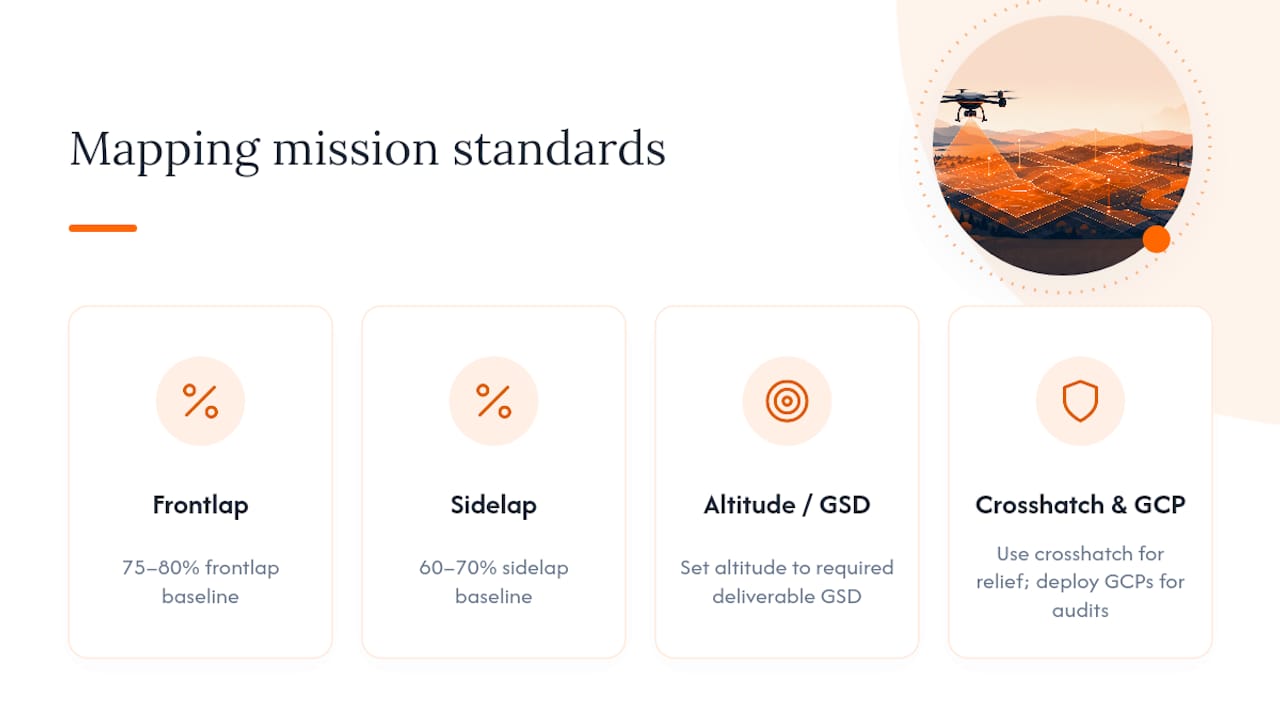
Mapping and survey work lives and dies on GSD and overlap discipline. Set your altitude to hit the tightest accuracy line item in the deliverable, hold to the 75 to 80 percent frontlap and 60 to 70 percent sidelap baseline, and switch to crosshatch patterns whenever the site includes buildings, dense tree cover, or anything with vertical relief that a single-direction grid will under-sample. GCP deployment matters most here, since surveys are the deliverable type most likely to face an accuracy audit.
Infrastructure inspection trades coverage efficiency for detail. You’ll fly oblique angles to capture facade and underside conditions a straight-down grid would miss entirely, and you’ll use orbits or loiter points around specific features like tower joints or roof penetrations instead of a continuous grid. The tradeoff is honest: more detail on fewer points means slower coverage of the full structure.
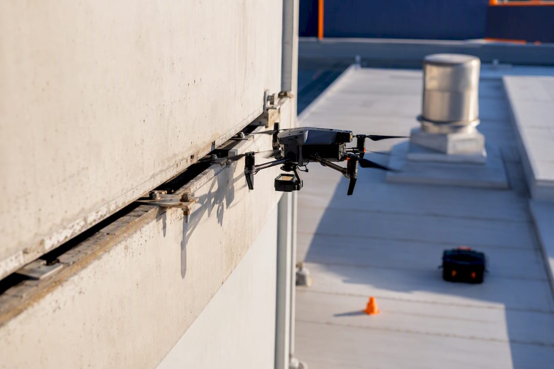
Corridor and facade work requires stitching together linear passes rather than a single polygon grid. Plan multiple altitude passes when the facade or corridor has varying height, and treat proximity planning as a safety requirement, not a nice-to-have, since these missions often put the aircraft close to structures, wires, or other obstacles that a standard mapping grid never encounters.
Where Dronable Fits Into the Mission Workflow
Every stage above still needs somewhere to live between missions. Dronable’s operations workspace maps directly onto that gap. SkyScore™ handles airspace safety checks before you commit to a flight plan, replacing a manual authorization lookup with a faster clearance step. Deal Studio manages the client side, turning a mapping or inspection job into a documented proposal and delivery record instead of a scattered email thread.
Drone Passport stores digital credentials so certification status travels with you between jobs and clients. Automated flight logs capture the record you need for audits, insurance, or a client who wants proof the mission happened as planned. The Operations Manual tools give crews a standardized checklist for prefetching maps, verifying imagery, and transferring plans to an autopilot, the same field steps covered above, built into a repeatable template instead of a mental list.
For pilots preparing for FAA or EASA certification, the Academy rounds out exam prep alongside the operational tools.
The Part of Mission Planning Most Operators Get Backward
Most guidance on this topic front-loads flight geometry, altitude, overlap percentages, pattern selection, as if those numbers are the hard part. They’re not. The hard part is defining the deliverable accuracy before you open your planning software at all, and most operators skip straight to picking a grid because it feels like the “real” work.
That habit is backward. Independent checkpoints are the only real way to confirm a survey met its spec, according to Aerocartwright’s workflow guidance, which means your accuracy target has to exist as a number before you fly, not as a vague sense that “higher resolution is better.” Flying tighter overlap and lower altitude than the job needs isn’t caution. It’s wasted battery, wasted flight time, and a bloated dataset that takes longer to process for no accuracy gain the client asked for or will pay for.
What should change first: treat the deliverable conversation with the client as part of the mission plan, not a separate scoping call that happens before “real” planning starts. Write the accuracy number down. Then let it drive your altitude, overlap, and positioning choices in that order. The administrative side, client sign off, credential tracking, flight logs, is where most solo operators lose the time they could be spending on the actual flight. That’s the piece worth automating rather than the piece worth guessing on.
Plan the Mission. Let Dronable Handle the Rest.
Every checklist in this article assumes you have somewhere to put the results, an authorization record, a client proposal, a flight log that proves the mission happened as planned. Most operators juggle that across three or four disconnected apps, and it’s usually the admin side that eats the hours a good flight plan just saved you.

Dronable puts airspace clearance, client management, and mission documentation in one workspace instead of scattered tools. SkyScore™ checks your airspace before launch, Deal Studio turns a completed mapping or inspection job into a client-ready proposal, and Drone Passport keeps your certifications and flight logs in one verifiable record. If you’re planning mapping, survey, or inspection missions regularly, this is the layer that sits underneath the flight plan itself. Visit Dronable to see the tools, or check the Operations Manual for field-ready templates you can start using on your next site visit.
Sources
- Mission Planner flight plan docs — ArduPilot
- UAV drone survey workflow: end-to-end process — KOREC
- The drone surveying workflow — Aerotas
Recommended
Explore Dronable Tools
Deepen Your Knowledge
Get step-by-step video courses in the Dronable Academy — FAA Part 107, EASA, real estate drone photography, and more.
Browse CoursesFree: How to Start a Drone Business
The complete step-by-step guide to turning your passion for flying into a profitable drone business — completely free.
- 10 steps to launching your drone business
- 51 proven drone business ideas
- How to get FAA certified (Part 107)
- Pricing, clients & recurring income
Join the Dronable Newsletter
Get drone tips, new articles, and exclusive deals straight to your inbox. No spam, unsubscribe anytime.


