SORA Ready Drone Risk Assessment: Fillable 10 Step Form for Pilots
SORA Ready Drone Risk Assessment: Fillable 10 Step Form for Pilots
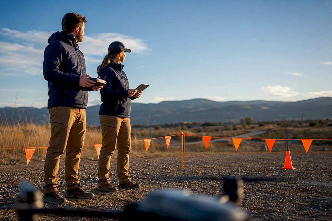
Run a documented preflight risk assessment before every flight: identify hazards, score likelihood against severity, assign mitigations, and record the final go or no-go decision. The deliverable is a filled-out risk-assessment form, not a mental checklist. Regulators anchor this expectation in SORA, and a recent quantitative study confirms why paperwork alone won’t cut it.
- All risk assessments must be documented with a formal form, not just mental checklists, and include detailed hazard identification, scoring, and mitigations.
- The risk score determines whether the operation can proceed, with low scores allowing standard procedures and high scores requiring additional mitigations or delaying the flight.
- Weather and human factors are the leading causes of drone accidents, so environmental checks and crew briefings should be performed before every flight.
- Proper documentation, including signed forms, weather screenshots, site photos, and flight logs, is essential for regulatory compliance and client proof.
- Use primary regulatory guidance and reliable tools that capture time-stamped evidence, and update risk assessments continuously based on changing conditions.
Table of Contents
- What Goes On A Drone Risk Assessment Form?
- How Do You Run A Drone Risk Assessment Step By Step?
- What Is SORA, And When Do You Actually Need It?
- Why Do Weather And Human Error Cause The Most Drone Accidents?
- How Do You Document A Drone Risk Assessment For Clients Or Regulators?
- Where Can You Find Reliable Drone Safety Tools And Guidance?
- Does Drone Type Or Payload Change How You Assess Risk?
- Should Cybersecurity Be Part Of Your Drone Risk Assessment?
- What Should Your Emergency Response Plan Cover?
- How Do You Train Crew To Do Risk Assessments Well?
- Treat Every Assessment As A Living Document, Not A Form
- How Dronable Simplifies Risk Documentation
- Sources
What Goes On A Drone Risk Assessment Form?
A usable form has to work fast in a parking lot and hold up later in front of a client or an inspector. That means fixed fields, not open-ended notes.
The core fields any drone risk assessment template needs:
- Operation title, date, and time window
- Pilot and crew names, roles, and current certifications
- ConOps summary: what the drone is doing, for how long, and why
- Operational volume coordinates or KML file, plus the contingency volume
- Aircraft make, model, and characteristic dimension (wingspan or diagonal)
- People at risk: bystanders, workers, spectators, nearby property
- Intrinsic ground risk inputs: population density, sheltering, max dimension
- Weather snapshot: wind, visibility, precipitation, temperature at time of flight
- Mitigations applied: strategic, tactical, and effect-reduction (covered below)
- Residual risk score and final sign-off, with a named approver
Score each hazard on a simple likelihood times severity grid, then note what mitigation brings the residual score down to something acceptable.
| Risk level Likelihood x severity Typical action | ||
| Low | 1 to 4 | Fly with standard procedures |
| Medium | 5 to 9 | Add a mitigation, brief the crew, proceed |
| High | 10 to 15 | Add multiple mitigations or delay |
| Unacceptable | 16 to 25 | No-go until risk is redesigned |
Two variants cover most operators. A one-page quick preflight version handles routine Open-category flights: hazards, weather, go/no-go, signature. An expanded annex version, closer to what a municipal risk-assessment template or a SORA submission demands, adds the ConOps narrative, KML attachments, and detailed OSO evidence. Build both once, reuse them every flight.
How Do You Run A Drone Risk Assessment Step By Step?
The process below matches what safety risk management literature recommends: system analysis, hazard identification, risk estimation, then mitigation. It works whether you’re shooting a backyard listing or filing for a specific-category approval.
- Describe the ConOps. Write what the aircraft does, define the operational volume where it’s actually supposed to be, and add a contingency volume for drift or a lost-link scenario. Export the flight area as a KML file and attach it. Practitioners preparing SORA packages reference this file directly in the ConOps section rather than describing coordinates in prose.
- Identify hazards. Walk the site or the map and list what could go wrong: controlled airspace nearby, crowds or vehicles below, tall structures, radio or electromagnetic interference near power infrastructure, and any loss of visual line of sight. Write each hazard as a specific sentence, not a category label.
- Analyze the risk. Pick a likelihood times severity scale (1 to 5 on each axis works for most operations), score every hazard, and multiply. This gives you the intrinsic risk before mitigation.
- Apply mitigations. Strategic mitigations change the operation itself: fly at a different time, shrink the area, add a buffer distance. Tactical mitigations manage risk during flight: visual observers, detect-and-avoid procedures, radio coordination. Effect-reduction mitigations limit harm if something fails: tethers, parachute systems, frangible propellers. Note which mitigation you used and its robustness, since a documented low-robustness fix carries less weight in an audit than a tested one.
- Verify and review. Someone other than the flying pilot should sign off on operations above Low risk. Re-run the assessment if weather, crew, or the operational area changes, and record the final decision with a timestamp.
Pro Tip: Keep a blank copy of your form on your phone. A risk assessment written after the incident, from memory, convinces nobody.
What Is SORA, And When Do You Actually Need It?
SORA (Specific Operations Risk Assessment) is the process regulators use to evaluate specific-category drone operations that fall outside Open category, Standard Scenarios, or Predefined Risk Assessments. If your flight fits neatly into one of those simpler frameworks, you likely don’t need full SORA. If it doesn’t, whether that’s flying over people, beyond visual line of sight, or in a busier airspace, SORA is the path.
The framework runs as a 10-step process combining ground risk and air risk. Ground Risk Class (GRC) depends on your aircraft’s characteristic dimension and the population density under the flight path; strategic and effect-reduction mitigations can lower it, but each one needs documentation tying it to a test report or procedure, per JARUS SORA v2.5. Air Risk Class (ARC) accounts for the airspace you’re operating in. Combine both and you get a SAIL (Specific Assurance and Integrity Level) rating, which sets the Operational Safety Objectives (OSOs) you must satisfy.
Practical fallout from this: expect a far more detailed ConOps than a hobbyist checklist, quantitative arguments for both ground and air risk, and a paper trail of evidence for every OSO you claim. Treat SORA as a tailoring guide rather than a form to fill in once. National aviation authorities typically review SORA submissions through several rounds of exchange before granting authorization, so build in time for clarification requests rather than expecting a single approval pass.
- SORA applies when Open/STS/PDRA categories don’t cover your operation
- GRC and ARC combine into a SAIL rating that sets your OSO requirements
- Every mitigation claimed needs supporting evidence, not just a description
- Expect iterative back-and-forth with your national authority, not instant approval
Why Do Weather And Human Error Cause The Most Drone Accidents?
A 2026 Bayesian network study modeling systemic UAV risk found that adverse weather and terrain are the single most dominant drivers of operational risk, ahead of mechanical failure or airspace congestion.
That changes where you should spend your attention. Environmental checks worth running every time:
- Wind speed and gust spread against your aircraft’s rated limits
- Precipitation and visibility, including expected changes during the flight window
- Low-level wind shear near buildings or ridgelines
- Terrain-induced turbulence around canyons, tree lines, or structures
- A quick RF interference scan near power lines or cell infrastructure
- Local NOTAMs and any temporary UTM restrictions
Human-factor controls matter just as much. Run a short crew brief before every flight, check for fatigue honestly, work through a fixed cognitive checklist rather than a mental scan, and agree on a communication plan for observers. Set a re-assessment trigger: if wind picks up, a bystander wanders into the area, or the crew’s confidence drops, stop and reassess on the spot rather than pushing through.
Pro Tip: If you notice yourself rationalizing a marginal weather call (“it’s probably fine”), that’s the moment to land. The Bayesian study’s own finding about decision-making under stress applies most exactly to that instant.
How Do You Document A Drone Risk Assessment For Clients Or Regulators?
A risk assessment that exists only in your head, or gets deleted after the flight, is worthless the moment someone asks for proof. Keep a minimum record set for every job:
- The completed risk-assessment form itself, signed
- A weather screenshot timestamped to the flight window
- The flight plan or KML file showing operational and contingency volumes
- Photos of the launch and landing site
- Names of any observers or witnesses present
- The final sign-off, including who approved the go decision
Storage matters as much as content. Cloud logs with automatic timestamps beat a folder of loose photos, and versioned PDF exports give you a clean file to hand a client or inspector without editing risk. Cross-link your risk assessment to your automated flight log so the two documents tell the same story, same times, same coordinates, same aircraft.
Regulators and clients tend to ask for the same things: proof you considered the airspace, proof you checked weather, and proof someone signed off before the aircraft left the ground. A scattered set of screenshots and text messages technically satisfies that, but it takes hours to assemble under pressure. Platforms built around flight logging exist specifically because reconstructing this after the fact, three months later, for an insurance claim, is far harder than capturing it once at the time of flight.
Where Can You Find Reliable Drone Safety Tools And Guidance?
Skip the SEO guides and go to primary sources first. EASA’s SORA guidance and the UK CAA’s SORA pages cover the regulatory framework directly; JARUS publishes the underlying methodology docs that national authorities build their rules from.
For day-of-flight data, national meteorological services and NOTAM portals remain the most reliable free tools, alongside terrain maps and UTM airspace layers from your national aviation authority.
When picking any tool to support your workflow, the capability that actually matters is evidence capture: time-stamped logs, GeoKML export for your operational volume, one-click weather snapshot capture, and the ability to attach photos or documents directly to a flight record. A spreadsheet can technically do all of this. It just takes longer and gets skipped under deadline pressure.
- SkyScore™ scores airspace safety before you launch, cutting manual airspace research
- Automated flight logs timestamp every flight without a separate spreadsheet
- Drone Passport stores your credentials and certifications in one verifiable place
- An Operations Manual template helps structure your ConOps for SORA-style submissions
Does Drone Type Or Payload Change How You Assess Risk?
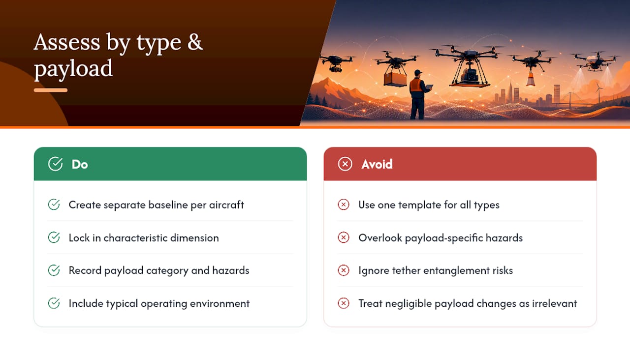
A DJI Mini flying at 249 grams and a fixed-wing mapping aircraft with a 1.5 meter wingspan don’t belong on the same risk assessment template, even though the fields are identical. Characteristic dimension drives your Ground Risk Class directly, so a heavier or larger aircraft starts at a higher baseline risk before any mitigation gets applied.
Payload changes the calculation in ways that are easy to overlook. A thermal camera adds negligible weight and negligible new risk. A sprayer carrying agricultural chemicals adds a contamination hazard if the aircraft goes down, which belongs in your hazard list even though it has nothing to do with flight mechanics. A tethered drone used for persistent surveillance introduces a physical line-of-sight and entanglement hazard that a free-flying aircraft never faces, but it also may qualify for an effect-reduction mitigation credit under SORA’s containment provisions.
Multirotor aircraft generally handle wind and hover-based tasks better; fixed-wing aircraft cover distance more efficiently but need longer contingency volumes because of stall speed and turning radius. If you fly more than one aircraft type, build a separate baseline risk profile for each rather than reusing one template across your entire fleet. The characteristic dimension, payload category, and typical operating environment should all be locked into that baseline before you ever get to the site-specific hazards on the day.
Should Cybersecurity Be Part Of Your Drone Risk Assessment?
Most preflight checklists still treat cybersecurity as someone else’s problem. That’s a gap. A drone’s command link, telemetry stream, and any cloud-connected flight-logging app are all attack surfaces, and GPS spoofing or signal jamming near sensitive sites (airports, government facilities, large public events) is a documented real-world hazard, not a theoretical one.
Add a short cybersecurity pass to your hazard identification step. Check whether your control link uses encrypted communication, confirm your firmware is current, and be aware of the RF environment you’re flying in, since dense urban cores and secured facilities are the most common places to encounter deliberate interference. If your aircraft or software logs flight data to the cloud, know where that data lives and who can access it, particularly on jobs involving client property or sensitive site imagery.

This matters more for commercial work than casual recreational flying, but the baseline habit is cheap: note your data-handling practice on the risk-assessment form itself, even as a single line, so a client or regulator asking about data security later finds an answer instead of a shrug. As drone operations increasingly touch critical infrastructure inspection and public-safety work, expect this line item to move from optional to expected.
What Should Your Emergency Response Plan Cover?
A risk assessment tells you what could go wrong. An emergency response plan tells you what to do the moment it does. Every operation above the most routine hobbyist flight needs both, and they should live in the same document set, not separate ones nobody checks.
At minimum, plan for four scenarios: lost link, low battery return, flyaway, and a crash or hard landing near people or property. For each, write the actual sequence: who calls it, what the pilot does with the controls, who clears the area, and who makes the notification call if there’s an injury or property damage. Keep emergency contact numbers, including local air traffic control and your own incident reporting chain, written on the form itself rather than assumed to be in someone’s phone.
Contingency volumes, defined back in your ConOps, exist precisely for this. If the aircraft drifts or loses link, the contingency volume is where it’s expected to go, and your ground crew should know that boundary before launch, not learn it mid-incident. Practice the flyaway procedure occasionally rather than trusting it will come back on its own the first time you actually need it.
How Do You Train Crew To Do Risk Assessments Well?
A risk-assessment form is only as good as the person filling it out, and treating that person’s competency as a given is a mistake. Someone can hold a valid remote pilot certificate and still fill out a hazard list badly, either by rushing it or by not knowing what a real hazard looks like on an unfamiliar site.
Build a short internal competency check for anyone conducting assessments on your crew: can they identify at least three site-specific hazards beyond the generic list, can they correctly score a likelihood times severity matrix, and do they know when to escalate a borderline call to a second person rather than deciding alone. New crew members should shadow an experienced assessor on two or three live jobs before signing off independently.
Formal training helps close the gap between certification and competency. Courses that go beyond exam prep into scenario-based decision-making, the kind covered in Dronable’s Academy, give newer pilots practice recognizing hazards before they’re standing on a real site under time pressure. Revisit competency periodically, not just once at hiring, since the hazards that matter shift as your operations expand into new environments or aircraft types.
Treat Every Assessment As A Living Document, Not A Form
A risk assessment isn’t something you fill out once and file away. Reassess the moment any variable changes: wind picks up, a new bystander enters the area, the aircraft swaps, and always run it again immediately before the aircraft leaves the ground, even if you did the same job last week at the same site.
The most common mistake experienced operators make isn’t skipping the paperwork. It’s treating the form as a compliance box rather than an active decision tool they actually consult mid-operation. The best pilots treats the completed form as a working reference, not a formality signed before takeoff and forgotten.
How Dronable Simplifies Risk Documentation
Building a defensible risk record by hand, spreadsheet here, weather screenshot there, KML file buried in an email, works until you’re asked to produce it fast for a client or an inspector. Dronable pulls that into one workspace: SkyScore™ checks airspace safety before you commit to a job, automated flight logs timestamp every flight without separate note-taking, and the Operations Manual tools help structure a ConOps that holds up under SORA-style scrutiny.

None of this replaces the judgment call on any given flight day. It just means the evidence you’d need to defend that call already exists in one place instead of scattered across three apps and a phone gallery. If you’re preparing documentation for a specific-category approval, the Operations Manual tools are built around exactly that structure. Pilots who want to sharpen the decision-making side of risk assessment, the human-factor piece the research keeps flagging as a weak point, can start with Dronable’s Academy training tracks. Check Dronable’s tools to see what fits your current workflow before your next job.
Sources
- A Bayesian network approach for systemic risk analysis in unmanned aerial vehicle (UAV) operations | Scientific Reports
- Specific Operations Risk Assessment (SORA) | EASA
- SORA v2.5 Main Body Release | JARUS (document copy)
- RISK ASSESSMENT | Rotherham Council (drone flight risk assessment template)
Recommended
Explore Dronable Tools
Deepen Your Knowledge
Get step-by-step video courses in the Dronable Academy — FAA Part 107, EASA, real estate drone photography, and more.
Browse CoursesFree: How to Start a Drone Business
The complete step-by-step guide to turning your passion for flying into a profitable drone business — completely free.
- 10 steps to launching your drone business
- 51 proven drone business ideas
- How to get FAA certified (Part 107)
- Pricing, clients & recurring income
Join the Dronable Newsletter
Get drone tips, new articles, and exclusive deals straight to your inbox. No spam, unsubscribe anytime.


